According to the Basic Mountaineering Course which teaches the basics of mountaineering, planning is the first thing to do when you're about to partake a climb, usually started 2 weeks ahead to even a month or more, before the actual climb. Well in our case, we started our planning phase started less than 24 hours before the actual climb :p
It was Day 2 of our rainy supposed to be Nagsasa Cove turned Anawangin Cove getaway, and the waves are still as ferocious as ever. And as per the previous blog post, we opted to just hike our way back to Brgy. Pundaquit by traversing Mt. Pundaquit since Island Hopping is not advisable on the current state of the sea. As this was an unexpected climb, mostly everyone in our group only have flip-flops as their footwear (I have my Nike Free Run 5.0 running shoes with me though :p) and we were scrambling for our leftover softdrink PET bottles as we haven't brought enough water containers for the water consumption of our group along the climb.
After all the preparations are over, we left all our luggage to our bangkero to take them back via boat and we met up with our guide Kuya James. We left the shores of Anawangin Cove at around 8 am and the sun is already high up. After just a few minutes of walking through woodlands, we encountered our first river crossing and my shoes got wet early on. Boy, it was real hard walking with your rubber shoes soaking wet >.<
If you are gonna do a climb of Mt. Pundaquit during the rainy season, I'd really recommend to use sandals or shoes that doesn't accumulate water as there are countless mini rivers that you have to cross.
 |
| One of the countless mini rivers flowing from the mountains to the open sea |
 |
| Around this part, It's really hard to tell where the correct trail is. Good thing we have a guide |
 |
| Lots of rocks along the way, presumably, this is a part of a riverbed during rainy season |
 |
| This seems to be the widest river that we have crossed during that time |
 |
| You might not see it much in the picture, but the current is actually strong |
 |
| There are supposed to be lots of wild carabaos roaming along the trail but we haven't encountered one, only their poopoo :p |
The early parts of trail is just easy, ranging from muddy woodlands, river crossings and rocky riverbeds. What surprised me is the trail just changed instantly to a sudden ascent. The climb from Anawangin Cove to the summint is real steep. By steep I mean really STEEP! What made it harder is the soil is a bit soft and wet because of the rains last night and there is very little shade along the way. Our guide said that the trail is just continuously like that all the way up to summit O_O
 |
| Slippery and soft mud with lots of tiny sharp rocks |
 |
| Poor them who had to climb using their flip-flops >.< |
After an exhausting 2 hours, we finally reached what our guide told us as the "Third Summit" of Mt. Pundaquit. It rewarded us with a really nice view of Anawangin cove. Up in the summit is also where you can finally get cellphone signal after you got cut off from civilization in Anawangin cove :p
 |
| Our guide Kuya James |
 |
| All exhausted >.< |
 |
| No time to be exhausted! It's time for some picture taking :p |
 |
| This is part is what our guide told us as the actual summit of Mt. Pundaquit. It has a separate trail going up that deviates from the main trail. |
 |
| Photobomb level: beginner :p |
We took quite some time resting and exploring the summit. Our guide shared us that there was once a sari-sari store on the summit. What we only found are some traces that there was a hut that is used to be standing in there and oh, lots of trash :(
 |
| View from the summit at the opposite side of Anawangin Cove |
We started our descent at around 10:30 AM. The trail was fairly easy as it was not steep like our climb to the summit. Just need to be careful as the mud is still slippery with only tall grass to grab hold on. What made the descent harder is the heat of the sun just got more intense.
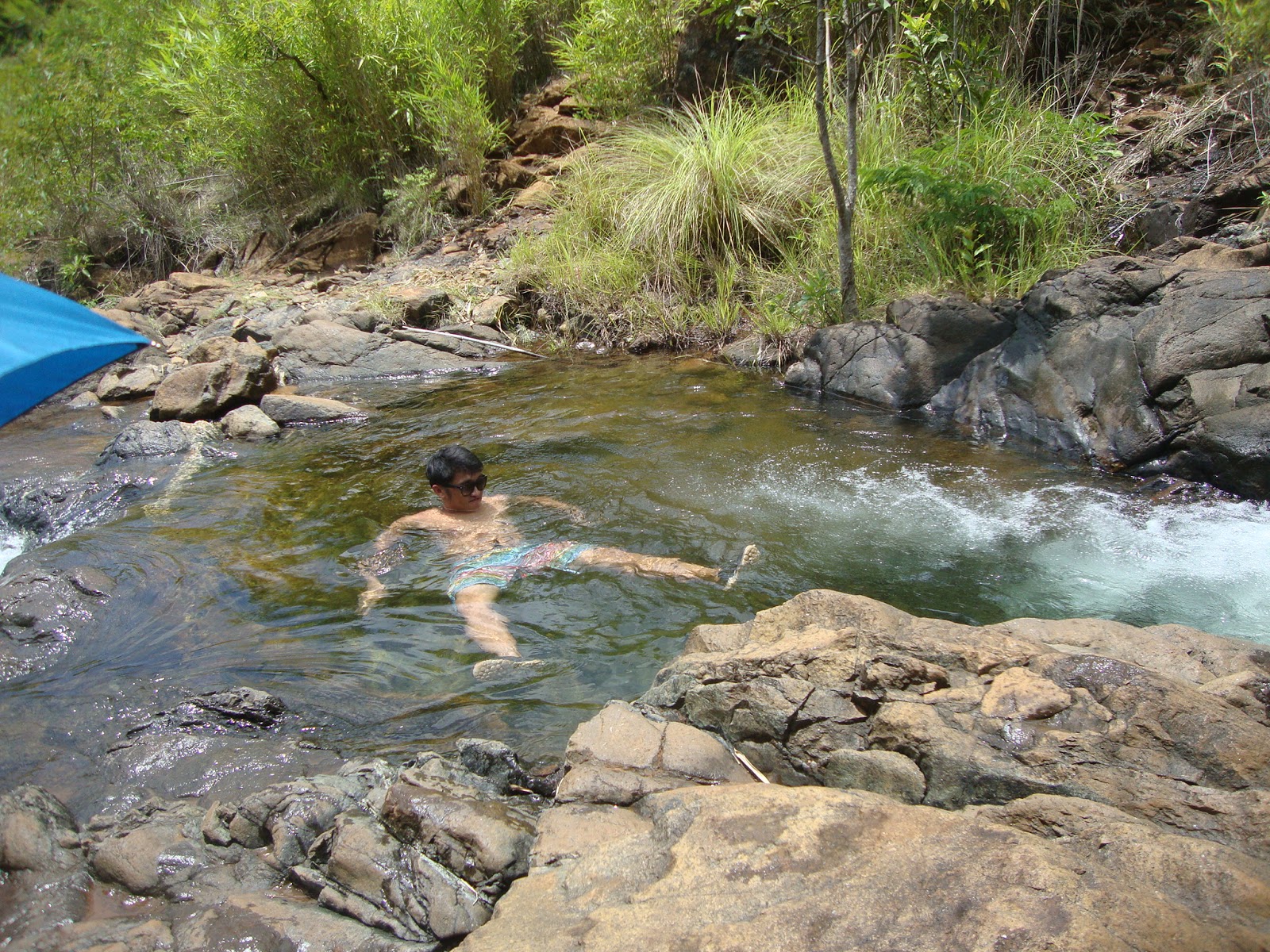
Around and hour descending, our water supplies were almost empty but our guide advised us that there is a water source nearby that we can drink and even bathe on. We reached the river a few minutes after and the water really is cold and crystal clear. Some refilled their water supply and two of the guys in our group even decided to take a dip while I just rested under the shade.
After the water source, the trail is even easier as we were in the last leg of the descent. What followed after the descent is some walk through thin woodlands and another river crossing.
 |
| Final river crossing for the hike |
 |
| Grassy and sandy trails leading to Brgy. Pundaquit |
After the river crossing is again some thin woodlands and after that is
just a walk through grasslands all the way back to Brgy. Pundaquit. The hike overall took us around 5 hours. To our surprise, the place we arrived in at Brgy. Pundaquit is also the place where we were brought to ride the boat to Anawangin Cove yesterday. We then walked all the way back to the place where we first met with our contact Kuya Alan, as it has a water source and changing room so that we can freshen up and prepare our things before heading back home. Our van service arrived not long after with all our luggage safely brought back from Anawangin Cove. Phew! :p
After freshening up, the van took us to Kuya Alan's place to pay the rest of our balance and bid our thanks and goodbyes.
Overall, this weekend trip was a good experience with lots of ups and downs and good and bad along the way, but the best thing is we all had fun even though we're all exhausted. But I'm still not contented as I still haven't seen Anawangin Cove and It's beauty during the summer and I've yet to visit the sandbar on Camara Island or the lighhouse at Capones Island! You can also add Nagsasa Cove to that list! I promise that I won't only be back... I'll be back with a vengeance!! haha :))


No comments:
Post a Comment